| Version 18 (modified by , 7 years ago) ( diff ) |
|---|
GRASS GIS 7.2.3
Table of Contents
A short summary of LTS changes: New features in GRASS 7.2 (note: current is New features in GRASS 7.4)
Releases
Stable Release
- Release date: 22 Mar 2018
Announcement: tbd- Changelog: https://grass.osgeo.org/grass72/source/ChangeLog_7.2.3.gz
- Binaries: https://grass.osgeo.org/download/software/#g72x
- Source code: https://grass.osgeo.org/grass72/source/grass-7.2.3.tar.gz (md5sum)
- SVN Source Code Checkout 7.2.3:
svn checkout https://svn.osgeo.org/grass/grass/tags/release_20180322_grass_7_2_3
Release Candidate 1 (RC1)
- Release date: 10 Mar 2018
- Changelog: https://grass.osgeo.org/grass72/source/ChangeLog_7.2.3RC1.gz
- Binaries: https://grass.osgeo.org/download/software/#G72x
- Source code: https://grass.osgeo.org/grass72/source/grass-7.2.3RC1.tar.gz (md5sum)
- SVN Source Code Checkout 7.2.3RC1:
svn checkout https://svn.osgeo.org/grass/grass/tags/release_20180310_grass_7_2_3RC1
SVN Source Code
- Milestone: 7.2.3
- SVN Checkout latest 7.2 release branch (including yet unpublished bugfixes):
svn checkout https://svn.osgeo.org/grass/grass/branches/releasebranch_7_2
Overview of changes
This is a bug fix release. A series of stability fixes, manual improvements, and a few language translations have been added.
The GRASS GIS 7.2.3 release provides more than 230 fixes and improvements with respect to the stable release 7.2.2.
Minor module changes
(see also below for closed bugs)
- grass startup script: added version output 'grass72 --config version'
- G72:d.mon: notes on functionality added
- G72:i.vi: fix typo in NDVI from Sentinel bands
- G72:r.in.srtm: Print an error instead of fail in XY location
- G72:r.out.gdal: export inf values
- G72:r.random.surface: rename variable Surface to RSurface to avoid compiler error
- G72:r.stream.extract: remove problematic infinity as default, use 64 bit integer to support large regions
- G72:r.viewshed: fix binary output
- G72:r.watershed: reduce chance of integer overflow
- G72:t.info: activate -h flag, fixes #3322
- G72:t.rast.mapcalc and G72:t.rast.algebra: manual edits (trunk, r71879)
- G72:v.external: notes on limitations added to the manual
- G72:v.external: mixed up IDs from PostGIS tables, fixes #3248
- G72:v.import: do not snap by default
- G72:v.info: Added layer specific database information to extended metadata
- G72:v.voronoi: update parameter description
Library changes
- use GEOS C API (#3421). Credits to Bas Couwenberg
- diglib: fix bug caused by compiler optimizations
- iostreamlib: fix memory manager
- pythonlib: add addon bin dir to path on all platforms
- rasterlib: Eliminate RPC/XDR dependency from raster library
Portability changes
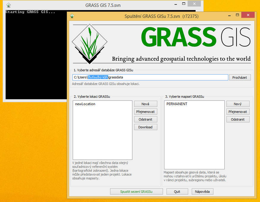
- fix startup on MS Windows when username contains non-ascii characters, #3508
Improvements in the Graphical User Interface
- G72:wxGUI: fix WMS service in latlong locations
User Manuals - Documentation
- Various manual pages: new screenshots added, thanks to Google Code-in
- Added missing height HTML tags according to submitting rules (needed for wxGIU html browser)
Message Translations
- Translations now managed in Transifex (please join and translate messages): https://www.transifex.com/grass-gis/grass72
Dockerfile
- Updated, docker image available e.g. at https://hub.docker.com/r/neteler/grassgis7/
New Addons since GRASS 7.2.2
- G7A:g.download.location: get, extract and place location from any URL
- G7A:i.cutlines: Creates semantically meaningful tile borders
- G7A:i.pysptools.unmix: Extract endmembers from imagery group and perform spectral unmixing using pysptools
- G7A:i.sentinel.download: Downloads Sentinel satellite data from Copernicus Open Access Hub using sentinelsat library
- G7A:i.sentinel.import: Imports Sentinel satellite data downloaded from Copernicus Open Access Hub using G7A:i.sentinel.download
- G7A:r.clip: simple module to crop rasters to region
- G7A:r.spread.sod: Stochastic landscape spread model of forest pathogen - Sudden Oak Death (SOD)
Closed tickets
Closed bugs since the last release
- #2370
- g.html2man.py fails while processing keyword list
- #3119
- r.out.,gdal -c should not write Metadata: COLOR_TABLE_RULE_RGB
- #3248
- v.external: mixed up IDs from PostGIS tables
- #3322
- t.info: h-flag has no effect
- #3369
- Followup to area calculation fix in changeset 71169
- #3388
- Legacy appstream metadata
- #3421
- GEOS C API usage
- #3508
- grass start up: buggy to_text_string
Closed wishes since the last release
No results
Attachments (1)
- grass-error-fixed.png (167.0 KB ) - added by 7 years ago.
Download all attachments as: .zip
Note:
See TracWiki
for help on using the wiki.

